The content of this website is no longer being updated. For information on current assessment activities, please visit http://www.globalchange.gov/what-we-do/assessment
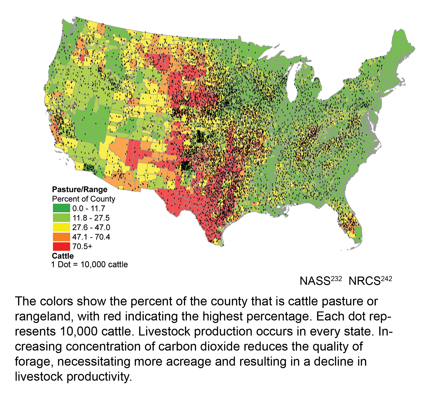
Distribution of Beef Cattle and Pasture/Rangeland in Continental U.S.

The colors show the percent of the county that is cattle pasture or rangeland, with red indicating the highest percentage. Each dot represents 10,000 cattle. Livestock production occurs in every state. Increasing concentration of carbon dioxide reduces the quality of forage, necessitating more acreage and resulting in a decline in livestock productivity. Image References: NASS1, NRCS2
References
- 1. [232] Service, National Agricultrual Statistics. 2002 Census of Agriculture. Washington, D.C.: USDA National Agricultural Statistics Service, 2002.
- 2. [242] Service, Natural Resources Conservation. 1997 Five-year Natural Resources Inventory. Washington, D.C.: USDA Natural Resources Conservation Service, 1997.
Summary
| High-resolution | High-resolution JPEG |
|---|