The content of this website is no longer being updated. For information on current assessment activities, please visit http://www.globalchange.gov/what-we-do/assessment
Northwest
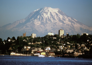 The Northwest’s rapidly growing population, as well as its forests, mountains, rivers, and coastlines, are already experiencing human-induced climate change and its impacts.1 Regionally averaged temperature rose about 1.5°F over the past century2 (with some areas experiencing increases up to 4°F) and is projected to increase another 3 to 10°F during this century.3 Higher emissions scenarios would result in warming in the upper end of the projected range. Increases in winter precipitation and decreases in summer precipitation are projected by many climate models,4 though these projections are less certain than those for temperature. Impacts related to changes in snowpack, streamflows, sea level, forests, and other important aspects of life in the Northwest are already underway, with more severe impacts expected over coming decades in response to continued and more rapid warming.
Snowpack and Streamflow
Declining springtime snowpack leads to reduced summer streamflows, straining water supplies.
The Northwest is highly dependent on temperature-sensitive springtime snowpack to meet growing, and often competing, water demands such as municipal and industrial uses, agricultural irrigation, hydropower production, navigation, recreation, and in-stream flows that protect aquatic ecosystems including threatened and endangered species. Higher cool season (October through March) temperatures cause more precipitation to fall as rain rather than snow and contribute to earlier snowmelt. April 1 snowpack, a key indicator of natural water storage available for the warm season, has already declined substantially throughout the region. The average decline in the Cascade Mountains, for example, was about 25 percent over the past 40 to 70 years, with most of this due to the 2.5°F increase in cool season temperatures over that period.5,6 Further declines in Northwest snowpack are projected to result from additional warming over this century, varying with latitude, elevation, and proximity to the coast. April 1 snowpack is projected to decline as much as 40 percent in the Cascades by the 2040s.7 Throughout the region, earlier snowmelt will cause a reduction in the amount of water available during the warm season.8
Trends in April 1 Snow Water Equivalent 1950 to 2002 April 1 snowpack (a key indicator of natural water storage available for the warm season) has declined throughout the Northwest. In the Cascade Mountains, April 1 snowpack declined by an average of 25 percent, with some areas experiencing up to 60 percent declines. On the map, decreasing trends are in red and increasing trends are in blue.9 Image Reference: University of Washington10In areas where it snows, a warmer climate means major changes in the timing of runoff: streamflow increases in winter and early spring, and then decreases in late spring, summer, and fall. This shift in streamflow timing has already been observed over the past 50 years,11 with the peak of spring runoff shifting from a few days earlier in some places to as much as 25 to 30 days earlier in others.12
This trend is projected to continue, with runoff shifting 20 to 40 days earlier within this century.12 Reductions in summer water availability will vary with the temperatures experienced in different parts of the region. In relatively warm areas on the western slopes of the Cascade Mountains, for example, reductions in warm season (April through September) runoff of 30 percent or more are projected by mid-century, whereas colder areas in the Rocky Mountains are expected to see reductions of about 10 percent. Areas dominated by rain rather than snow are not expected to see major shifts in the timing of runoff.13
Extreme high and low streamflows also are expected to change with warming. Increasing winter rainfall (as opposed to snowfall) is expected to lead to more winter flooding in relatively warm watersheds on the west side of the Cascades. The already low flows of late summer are projected to decrease further due to both earlier snowmelt and increased evaporation and water loss from vegetation. Projected decreases in summer precipitation would exacerbate these effects. Some sensitive watersheds are projected to experience both increased flood risk in winter and increased drought risk in summer due to warming.
Shift to Earlier Peak Streamflow Quinault River (Olympic Peninsula, northern Washington)") As precipitation continues to shift from snow to rain, by the 2040s, peak flow on the Quinault River is projected to occur in December, and flows in June are projected to be reduced to about half of what they were over the past century. On the graph, the blue swath represents the range of projected streamflows based on an increase in temperature of 3.6 to 5.4°F. The other lines represent streamflows in the early and late 1900s.4,14 Image Reference: University of Washington10The region’s water supply infrastructure was built based on the assumption that most of the water needed for summer uses would be stored naturally in snowpack. For example, the storage capacity in Columbia Basin reservoirs is only 30 percent of the annual runoff, and many small urban water supply systems on the west side of the Cascades store less than 10 percent of their annual flow.15 Besides providing water supply and managing flows for hydropower, the region’s reservoirs are operated for flood-protection purposes and, as such, might have to release (rather than store) large amounts of runoff during the winter and early spring to maintain enough space for flood protection. Earlier flows would thus place more of the year’s runoff into the category of hazard rather than resource. An advance in the timing of snowmelt runoff would also increase the length of the summer dry period, with important consequences for water supply, ecosystems, and wildfire management.12
As precipitation continues to shift from snow to rain, by the 2040s, peak flow on the Quinault River is projected to occur in December, and flows in June are projected to be reduced to about half of what they were over the past century. On the graph, the blue swath represents the range of projected streamflows based on an increase in temperature of 3.6 to 5.4°F. The other lines represent streamflows in the early and late 1900s.4,14 Image Reference: University of Washington10The region’s water supply infrastructure was built based on the assumption that most of the water needed for summer uses would be stored naturally in snowpack. For example, the storage capacity in Columbia Basin reservoirs is only 30 percent of the annual runoff, and many small urban water supply systems on the west side of the Cascades store less than 10 percent of their annual flow.15 Besides providing water supply and managing flows for hydropower, the region’s reservoirs are operated for flood-protection purposes and, as such, might have to release (rather than store) large amounts of runoff during the winter and early spring to maintain enough space for flood protection. Earlier flows would thus place more of the year’s runoff into the category of hazard rather than resource. An advance in the timing of snowmelt runoff would also increase the length of the summer dry period, with important consequences for water supply, ecosystems, and wildfire management.12
One of the largest demands on water resources in the region is hydroelectric power production. About 70 percent of the Northwest’s electricity is provided by hydropower, a far greater percentage than in any other region. Warmer summers will increase electricity demands for air conditioning and refrigeration at the same time of year that lower streamflows will lead to reduced hydropower generation. At the same time, water is needed for irrigated agriculture, protecting fish species, reservoir and river recreation, and urban uses. Conflicts between all of these water uses are expected to increase, forcing complex trade-offs between competing objectives (see Energy and Water sectors).4,14
Forests and Agriculture
Increased insect outbreaks, wildfires, and changing species composition in forests will pose challenges for ecosystems and the forest products industry.
Higher summer temperatures and earlier spring snowmelt are expected to increase the risk of forest fires in the Northwest by increasing summer moisture deficits; this pattern has already been observed in recent decades. Drought stress and higher temperatures will decrease tree growth in most low- and mid-elevation forests. They will also increase the frequency and intensity of mountain pine beetle and other insect attacks,16 further increasing fire risk and reducing timber production, an important part of the regional economy. The mountain pine beetle outbreak in British Columbia has destroyed 33 million acres of trees so far, about 40 percent of the marketable pine trees in the province. By 2018, it is projected that the infestation will have run its course and over 78 percent of the mature pines will have been killed; this will affect more than one-third of the total area of British Columbia’s forests17 (see Ecosystems sector). Forest and fire management practices are also factors in these insect outbreaks.11 Idaho’s Sawtooth Mountains are also now threatened by pine beetle infestation.
In the short term, high elevation forests on the west side of the Cascade Mountains are expected to see increased growth. In the longer term, forest growth is expected to decrease as summertime soil moisture deficits limit forest productivity, with low-elevation forests experiencing these changes first. The extent and species composition of forests are also expected to change as tree species respond to climate change. There is also the potential for extinction of local populations and loss of biological diversity if environmental changes outpace species’ ability to shift their ranges and form successful new ecosystems.
Agriculture, especially production of tree fruit such as apples, is also an important part of the regional economy. Decreasing irrigation supplies, increasing pests and disease, and increased competition from weeds are likely to have negative effects on agricultural production.
Coldwater Fish Populations
Salmon and other coldwater species will experience additional stresses as a result of rising water temperatures and declining summer streamflows.
Decreasing Habitat for Coldwater Fish Increasing air temperatures lead to rising water temperatures, which increase stress on coldwater fish such as trout, salmon, and steelhead. August average air temperature above 70°F is a threshold above which these fish are severely stressed. Projected temperatures for the 2020s and 2040s under a higher emissions scenario suggest that the habitat for these fish is likely to decrease dramatically.3,18,19,20 Image Reference: University of Washington10Northwest salmon populations are at historically low levels due to stresses imposed by a variety of human activities including dam building, logging, pollution, and over-fishing. Climate change affects salmon throughout their life stages and poses an additional stress. As more winter precipitation falls as rain rather than snow, higher winter streamflows scour streambeds, damaging spawning nests and washing away incubating eggs. Earlier peak streamflows flush young salmon from rivers to estuaries before they are physically mature enough for the transition, increasing a variety of stresses including the risk of being eaten by predators. Lower summer streamflows and warmer water temperatures create less favorable summer stream conditions for salmon and other coldwater fish species in many parts of the Northwest. In addition, diseases and parasites that infect salmon tend to flourish in warmer water. Climate change also impacts the ocean environment, where salmon spend several years of their lives. Historically, warm periods in the coastal ocean have coincided with relatively low abundances of salmon, while cooler ocean periods have coincided with relatively high salmon numbers.21,22
Most wild Pacific salmon populations are extinct or imperiled in 56 percent of their historical range in the Northwest and California,23 and populations are down more than 90 percent in the Columbia River system. Many species are listed as either threatened or endangered under the Federal Endangered Species Act. Studies suggest that about one-third of the current habitat for the Northwest’s salmon and other coldwater fish will no longer be suitable for them by the end of this century as key temperature thresholds are exceeded. Because climate change impacts on their habitat are projected to be negative, climate change is expected to hamper efforts to restore depleted salmon populations.
Coastal Areas
Sea-level rise along vulnerable coastlines will result in increased erosion and the loss of land.
Northwest Cities at Risk to Sea-Level Rise Highly populated coastal areas throughout Puget Sound, Washington, are vulnerable to sea-level rise. The maps show regions of Olympia and Harbor Island (both located in Puget Sound) that are likely to be lost to sea-level rise by the end of this century based on moderate and high estimates. Image Reference: Petersen24Climate change is projected to exacerbate many of the stresses and hazards currently facing the coastal zone. Sea-level rise will increase erosion of the Northwest coast and cause the loss of beaches and significant coastal land areas. Among the most vulnerable parts of the coast is the heavily populated south Puget Sound region, which includes the cities of Olympia, Tacoma, and Seattle, Washington. Some climate models project changes in atmospheric pressure patterns that suggest a more southwesterly direction of future winter winds. Combined with higher sea levels, this would accelerate coastal erosion all along the Pacific Coast. Sea-level rise in the Northwest (as elsewhere) is determined by global rates of sea-level rise, changes in coastal elevation associated with local vertical movement of the land, and atmospheric circulation patterns that influence wind-driven “pile-up” of water along the coast. A mid-range estimate of relative sea-level rise for the Puget Sound basin is about 13 inches by 2100. However, higher levels of up to 50 inches by 2100 in more rapidly subsiding (sinking) portions of the basin are also possible given the large uncertainties about accelerating rates of ice melt from Greenland and Antarctica in recent years (see Global and National Climate Change sections).25
An additional concern is landslides on coastal bluffs. The projected heavier winter rainfall suggests an increase in saturated soils and, therefore, an increased number of landslides. Increased frequency and/or severity of landslides is expected to be especially problematic in areas where there has been intensive development on unstable slopes. Within Puget Sound, the cycle of beach erosion and bluff landslides will be exacerbated by sea-level rise, increasing beach erosion, and decreasing slope stability.
Adaptation: Improved Planning to Cope with Future Changes
States, counties, and cities in the Northwest are beginning to develop strategies to adapt to climate change. In 2007, Washington state convened stakeholders to develop adaptation strategies for water, agriculture, forests, coasts, infrastructure, and human health. Recommendations included improved drought planning, improved monitoring of diseases and pests, incorporating sea-level rise in coastal planning, and public education. An implementation strategy is under development.
In response to concerns about increasing flood risk, King County, Washington, approved plans in 2007 to fund repairs to the county’s aging levee system. The county also will replace more than 57 “short-span” bridges with wider span structures that allow more debris and floodwater to pass underneath rather than backing up and causing the river to flood. The county has begun incorporating porous concrete and rain gardens into road projects to manage the effects of stormwater runoff during heavy rains, which are increasing as climate changes. King County has also published an adaptation guidebook that is becoming a model that other local governments can refer to in order to organize adaptation actions within their municipal planning processes.26
Concern about sea-level rise in Olympia, Washington, contributed to the city’s decision to relocate its primary drinking water source from a low-lying surface water source to wells on higher ground. The city adjusted its plans for construction of a new City Hall to locate the building in an area less vulnerable to sea-level rise than the original proposed location. The building’s foundation also was raised by 1 foot.
References
- 1. [34] Barnett, T. P., D. W. Pierce, H. G. Hidalgo, C. Bonfils, B. D. Santer, T. Das, G. Bala, A. W. Wood, T. Nozawa, A. A. Mirin et al. "Human-induced changes in the hydrology of the western United States." Science 319, no. 5866 (2008): 1080-1083.
- 2. [485] Mote, P. W.. "Trends in Temperature and Precipitation in the Pacific Northwest during the Twentieth Century." Northwest Science 77, no. 4 (2003): 271-282.
- 3. a. b. [486] Mote, P., E. Salathe, V. Duliere, and E. Jump. Scenarios of Future Climate for the Pacific Northwest. Seattle, WA: Climate Impacts Group, University of Washington, 2008.
- 4. a. b. c. [487] Hamlet, A. F., P. W. Mote, M. P. Clark, and D. P. Lettenmaier. "Effects of Temperature and Precipitation Variability on Snowpack Trends in the Western United States." Journal of Climate 18, no. 21 (2005): 4545-4561.
- 5. [108] Christensen, J. H., B. Hewitson, A. Busuioc, A. Chen, X. Gao, R. Held, R. Jones, R. K. Kolli, W. - T. Kwon, R. Laprise et al. "Regional climate projections." In Climate Change 2007: The Physical Science Basis, edited by S. Solomon, D. Qin, M. Manning, Z. Chen, M. Marquis, K. B. Averyt, M. Tignor and H. L. Miller, 847-940. Vol. Contribution of Working Group I to the Fourth Assessment Report of the Intergovernmental Panel on Climate Change. Cambridge UK and New York, NY: Cambridge University Press, 2007.
- 6. [488] Mote, P. W.. "Climate-driven Variability and Trends in Mountain Snowpack in Western North America." Journal of Climate 19, no. 23 (2006): 6209-6220.
- 7. [489] Payne, J. T., A. W. Wood, A. F. Hamlet, R. N. Palmer, and D. P. Lettenmaier. "Mitigating the Effects of Climate Change on the Water Resources of the Columbia River Basin." Climatic Change 62, no. 1-3 (2004): 233-256.
- 8. [68] Gutowski, W. J., G. C. Hegerl, G. J. Holland, T. R. Knutson, L. Mearns, R. J. Stouffer, P. J. Webster, M. F. Wehner, and F. W. Zwiers. "Causes of Observed Changes in Extremes and Projections of Future Changes." In Weather and Climate Extremes in a Changing Climate: Regions of Focus: North America, Hawaii, Caribbean, and U.S. Pacific Islands, edited by T. R. Karl, G. A. Meehl, C. D. Miller, S. J. Hassol, A. M. Waple and W. L. Murray, 81-116. Vol. Synthesis and Assessment Product 3.3. Washington, D.C.: U.S. Climate Change Science Program, 2008.
- 9. [491] Mote, P. W., A. F. Hamlet, M. P. Clark, and D. P. Lettenmaier. "Declining Mountain Snowpack in Western North America." Bulletin of the American Meteorological Society 86, no. 1 (2005): 39-49.
- 10. a. b. c. [490] various. footnote 490., 2009.
- 11. a. b. [252] Peterson, T. C., D. M. Anderson, S. J. Cohen, M. Cortez-Vazquez, R. J. Murnane, C. Parmesan, D. Phillips, R. Pulwarty, and J. M. R. Stone. "Why Weather and Climate Extremes Matter." In Weather and Climate Extremes in a Changing Climate - Regions of Focus: North America, Hawaii, Caribbean, and U.S. Pacific Islands, edited by T. R. Karl, G. A. Meehl, C. D. Miller, S. J. Hassol, A. M. Waple and W. L. Murray, 11-34. Vol. Synthesis and Assessment Product 3.3. Washington, D.C.: U.S. Climate Change Science Program, 2008.
- 12. a. b. c. [157] Stewart, I. T., D. R. Cayan, and M. D. Dettinger. "Changes in Snowmelt Runoff Timing in Western North America under a 'Business as Usual' Climate Change Scenario." Climatic Change 62, no. 1-3 (2004): 217-232.
- 13. [492] Hamlet, A. F., and D. P. Lettenmaier. "Effects of 20th Century Warming and Climate Variability on Flood Risk in the Western U.S." Water Resources Research 43 (2007).
- 14. a. b. [494] Casola, J. H., J. E. Kay, A. K. Snover, R. A. Norheim, L. C. Whitely Binder, and Climate Impacts Group. Climate Impacts on Washington's Hydropower, Water Supply, Forests, Fish, and Agriculture. Seattle, WA: Center for Science in the Earth System, Joint Institute for the Study of the Atmosphere and Ocean, University of Washington, 2005.
- 15. [493] Administration, Bonneville Power. The Columbia River System Inside Story In Internal Report - DOE/BP-3372. 2nd ed. Vol. 2nd Edition. Portland, OR: Bonneville Power Administration, 2001.
- 16. [243] Ryan, M. G., S. R. Archer, R. Birdsey, C. Dahm, L. Heath, J. Hicke, D. Hollinger, T. Huxman, G. Okin, R. Oren et al. "Land Resources." In The Effects of Climate Change on Agriculture, Land Resources, Water Resources, and Biodiversity in the United States, edited by P. Backlund, A. Janetos, D. Schimel, J. Hatfield, K. Boote, P. Fay, L. Hahn, C. Izaurralde, B. A. Kimball, T. Mader et al., 75-120. Vol. Synthesis and Assessment Product 3.3. Washington, D.C.: U.S. Department of Agriculture, 2008.
- 17. [495] of the Environment, Ministry. Environmental Trends 2007: The Mountain Pine Beetle in British Columbia. British Columbia, Canada: Ministry of the Environment, 2007.
- 18. [497] Salathe, E. P.. "Downscaling Simulations of Future Global Climate with Application to Hydrologic Modelling." International Journal of Climatology 25, no. 4 (2005): 419-436.
- 19. [568] Keleher, C. J., and F. J. Rahel. "Thermal Limits to Salmonid Distributions in the Rocky Mountain Region and Potential Habitat Loss due to Global Warming: A Geographic Information System (GIS) Approach." Transactions of the American Fisheries Society 125, no. 1 (1996): 1-13.
- 20. [569] McCullough, D., S. Spalding, D. Sturdevant, and M. Hicks. Issue Paper 5: Summary of Technical Literature Examining the Physiological Effects of Temperature on Salmonids In U.S. EPA Region 10 Temperature Water Quality Criteria Guidance Development Project. Seattle, WA: EPA Pacific Northwest Regional Office (Region 10), 2001.
- 21. [70] Janetos, A., L. Hansen, D. Inouye, B. P. Kelly, L. Meyerson, B. Peterson, and R. Shaw. "Biodiversity." In The Effects of Climate Change on Agriculture, Land Resources, Water Resources, and Biodiversity in the United States, edited by P. Backlund, A. Janetos, D. Schimel, J. Hatfield, K. Boote, P. Fay, L. Hahn, C. Izaurralde, B. A. Kimball, T. Mader et al., 151-181. Vol. Synthesis and Assessment Product 4.3. Washington, D.C.: U.S. Department of Agriculture, 2008.
- 22. [563] Crozier, L. G., A. P. Hendry, P. W. Lawson, T. P. Quinn, N. J. Mantua, J. Battin, R. G. Shaw, and R. B. Huey. "Potential Responses to Climate Change in Organisms with Complex Life Histories: Evolution and Plasticity in Pacific Salmon." Evolutionary Applications 1, no. 2 (2008): 252-270.
- 23. [496] Francis, R. C., and N. J. Mantua. "Climatic Influences on Salmon Populations in the Northeast Pacific." In Assessing Extinction Risk for West Coast Salmon, edited by A. D. MacCall and T. C. Wainwright, 37-67. Vol. NOAA Technical Memo - NMFS-NWFSC-56. Washington, D.C.: National Marine Fisheries Service, 2003.
- 24. [499] Petersen, A.. Anticipating Sea Level Rise Response in Puget Sound In School of Marine Affairs. Vol. Master of Marine Affairs. Seattle Washington: University of Washington, Seattle, 2007.
- 25. [498] Mote, P., A. Petersen, S. Reeder, H. Shipman, and L. C. Whitely Binder. Sea Level Rise Scenarios for Washington State. Seattle, WA: Washington Department of Ecology, Lacey, 2008.
- 26. [500] Snover, A. K., L. C. Whitely Binder, J. Lopez-Garcia, E. Willmott, J. E. Kay, D. Howell, and J. Simmonds. Preparing for Climate Change: A Guidebook for Local, Regional, and State Governments. Oakland, CA: King County, Washington, 2007.