The content of this website is no longer being updated. For information on current assessment activities, please visit http://www.globalchange.gov/what-we-do/assessment
Geographic Vulnerability of U.S. Residents to Selected Climate-Related Health Impacts

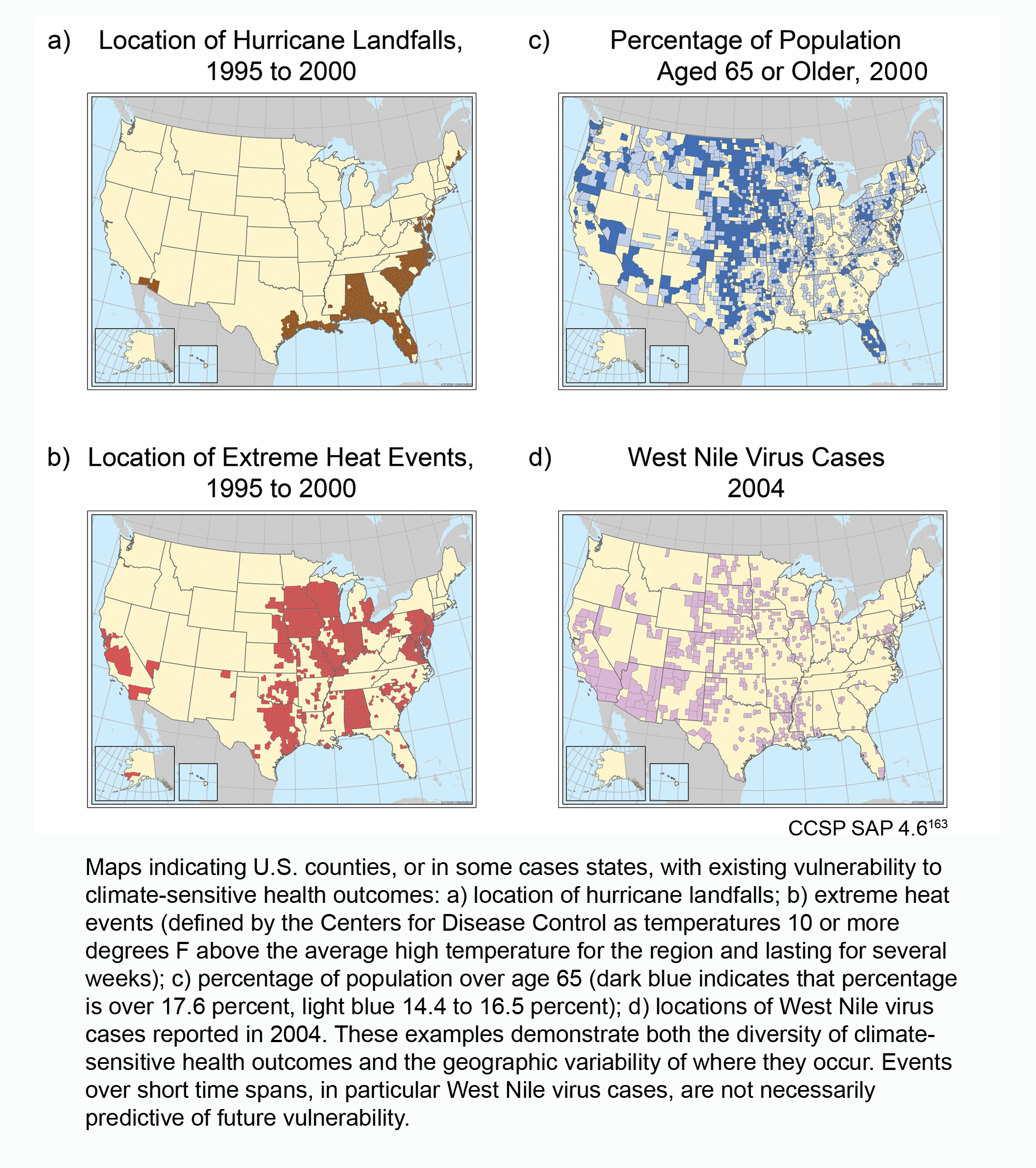
Maps indicating U.S. counties, or in some cases states, with existing vulnerability to climate-sensitive health outcomes: a) location of hurricane landfalls; b) extreme heat events (defined by the Centers for Disease Control as temperatures 10 or more degrees F above the average high temperature for the region and lasting for several weeks); c) percentage of population over age 65 (dark blue indicates that percentage is over 17.6 percent, light blue 14.4 to 17.5 percent); d) locations of West Nile virus cases reported in 2004. These examples demonstrate both the diversity of climate-sensitive health outcomes and the geographic variability of where they occur. Events over short time spans, in particular West Nile virus cases, are not necessarily predictive of future vulnerability. Image Reference: CCSP SAP 4.61
References
- 1. [163] Ebi, K. L., J. Balbus, P. L. Kinney, E. Lipp, D. M. Mills, M. S. O'Neill, and M. Wilson. "Effects of Global Change on Human Health." In Analyses of the Effects of Global Change on Human Health and Welfare and Human Systems, edited by J. L. Gamble, 39-87. Vol. Synthesis and Assessment Product 4.6. Washington, D.C.: U.S. Environmental Protection Agency, 2008.
Summary
| High-resolution | High-resolution JPEG |
|---|