The content of this website is no longer being updated. For information on current assessment activities, please visit http://www.globalchange.gov/what-we-do/assessment
Land Lost During 2005 Hurricanes

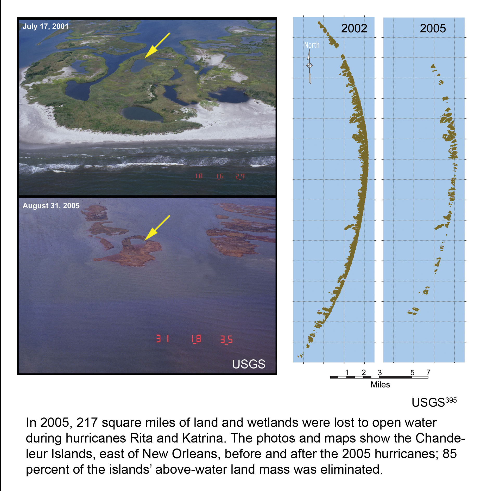
In 2005, 217 square miles of land and wetlands were lost to open water during hurricanes Rita and Katrina. The photos and maps show the Chandeleur Islands, east of New Orleans, before and after the 2005 hurricanes; 85 percent of the islands’ above-water land mass was eliminated. Image Reference: USGS1
References
- 1. [395] various. footnote 395., 2009.
Summary
| High-resolution | High-resolution JPEG |
|---|---|
| Photo Credit | Photographs from USGS |